 |
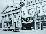
| Photo scanned from the Arcadia “Images of America – Lorain" book |
So Dennis ordered a proper scan of the full photo from the Lorain Historical Society (LHS) from their archives and was in for a big surprise.
“Aha!” exclaimed Dennis. "The photo in the book has been cropped, and the full picture reveals a lot.”
Referring to a comment left on my original blog post about the tower, Dennis noted, "First of all, one of Dan's readers wondered why another tower did not appear in the background.
"The answer is simple: It does. It was cropped out!”
Here is Dennis’ new scan from the LHS showing two towers on the right side of the photo. You can see a lot more of the tower, as well as a second tower off in the distance behind the first.

 |
| Close-up of towers |
Dennis studied the construction of the larger tower in the photo very closely, and then hit the road for some field research.
"I examined the closest tower very carefully and began driving the line,
from where those types of towers began near Falbo Ave, to where I lost track of
them south of Amherst,” he noted. "There are only two towers built like that one. The
distinguishing characteristic is the additional horizontal brace at the top of
the first bay, ten feet off the ground. Those two towers are the one where the
line crosses Cooper Foster Park Rd near North Main St, and the one on Leavitt Rd at Tower
Blvd. "Each location is a more stressed location. The one at Cooper Foster Park has an exceptionally long stretch to the next tower, and the one at Leavitt Rd is where the line changes direction and heads more south.”
Thanks to Dennis' meticulous attention to detail, he was able to determine conclusively where the towers are located.
Next: The Mystery Solved

No comments:
Post a Comment